
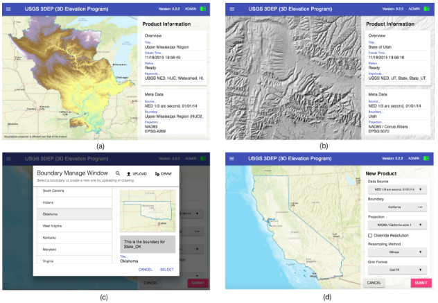
TopoLens is a cyberGIS app for delivering community data services developed for easy and efficient access to high-resolution topographic data. The app supports on-demand data and map services, powered by hybrid cyberinfrastructure with cloud and HPC support, to efficiently produce datasets that are customized based on user’s request. Currently, TopoLens has precomputed Digital Elevation model (DEM), slope and shaded relief data products at the state level (48 contiguous states and the District of Columbia) and at watershed region level (18 HUC2 Hydrologic Units) in the US, with 51 different map projections.
Sponsored by: National Science Foundation (NSF) and United States Geological Survey (USGS)
People: Hao Hu, Xingchen Hong, Jeff Tersiep, Mayank Kathuria, Shaowen Wang
Publications:
© CyberGIS Center