
Geospatial data science represents an emerging interdisciplinary and transdisciplinary field intersecting among three broad knowledge domains: geospatial sciences and technologies, mathematical and statistical sciences, and cyberinfrastructure and computational sciences. The core of this intersection encompasses fertile synergies and interactions between big data and cyberGIS with geospatial principles guiding discovery and innovation. The Geospatial Data Science Distinguished Speaker Series brings leading thinkers and practitioners in this exciting field to the University of Illinois at Urbana-Champaign to conduct public lectures and engage with the campus community.
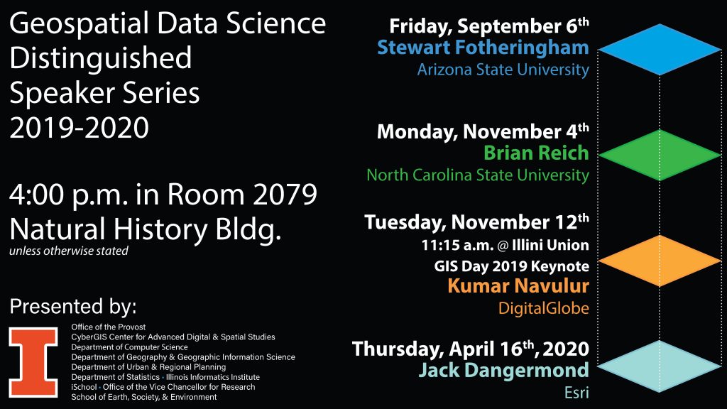
November 4, 2019 – Dr. Brian Reich – North Carolina State University
4:00 PM – 5:00 PM, Natural History Building, Lecture Hall 2079
Spatial Causal Inference Using Numerical Model
Wildland fire smoke contains hazardous levels of fine particulate matter (PM2.5), a pollutant showed to adversely affect health. Estimating fire-attributable PM2.5 concentrations is key to quantifying the impact on air quality and subsequent health burden. This is a challenging problem since only total PM2.5 is measured at monitoring stations and both fire-attributable PM2.5 and PM2.5 from all other sources are correlated in space and time.
We propose a framework for estimating fire-contributed PM2.5 and PM2.5 from all other sources using a novel causal inference framework and bias-adjusted chemical model representations of PM2.5 under counterfactual scenarios. The chemical model representation of PM2.5 for this analysis is simulated using Community Multi-Scale Air Quality Modeling System (CMAQ), run with and without fire emissions across the contiguous U.S. for the 2008-2012 wildfire seasons.
Sep 6, 2019 – Dr. Stewart Fotheringham – Arizona State University
4:00 PM – 5:00 PM, Natural History Building, Lecture Hall 2079
The Geography of Processes
Geographers have long been interested in the spatial distribution of data both in terms of visualization (maps) and statistical analysis (point pattern analysis, spatial autocorrelation, kriging, etc) but have essentially ignored the spatial distribution of processes. This seminar attempts to correct this bias by discussing the Geography of Processes through issues such as local modeling, scale, the role and measurement of locational context, and the implications of spatially varying processes for the transferability of models.
Apr 29, 2019 – Dr. Michael Batty – University College London
4:00 PM – 5:00 PM, Natural History Building, Lecture Hall 2079
Urban Informatics and the High-Frequency City
The rapid evolution of information technologies to the point where most active citizens are able to access global information using personal devices is changing the city out of all recognition. This lecture will outline the ways in which such technologies are generating a new functioning of the city which we call ‘urban informatics’, and we will explore the implications of these developments for our understanding of the city and its design.
Mar 27, 2019 – Dr. Craig Knoblock, University of Southern California
4:00 PM – 5:00 PM, Natural History Building, Lecture Hall 2079
Building Spatial Knowledge Graphs
You can download the slide deck here.
Mar 11, 2019 – Dr, Annette Kim, University of Southern California
4:00 PM – 5:00 PM, Natural History Building, Lecture Hall 2079
Translational Geospatial Data for a Democratic Future
Exciting possibilities are emerging for synergizing new kinds of data that can illuminate spatial patterns we could not have seen nor analyzed before. However, harnessing this potential requires deep trans-disciplinary, collaborative work between computer science, the social sciences, and the humanities. Critical groundtruthing, fieldwork, and participatory feedback are some strategies that can counter mistaken assumptions that become deeply embedded into how we encode data and then reify, privilege, and propagate biased representations of the world for policymaking and public services and investments.
February 6, 2019 – George Percivall (CTO & Chief Engineer, Open Geospatial Consortium (OGC))
4:00 PM – 5:00 PM, Natural History Building, Lecture Hall 2079
The Golden Age of Geospatial Data Science and Engineering
You can download the slide deck here.
© CyberGIS Center